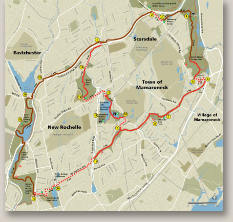
The Colonial Greenway Trail wends through four towns connecting what were formerly four trails with each leg having a local name and identity. The map shows the entire route with all access points identified.


The Colonial Greenway Trail wends through four towns connecting what were formerly four trails with each leg having a local name and identity. The map shows the entire route with all access points identified.