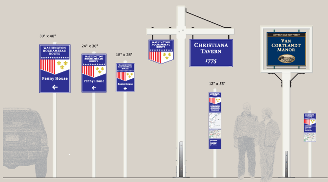
The Washington-Rochambeau Revolutionary Route extends from Newport, R.I., to Yorktown, Va., and back to Boston. The trail consists of a network of land and water routes traversing nine states and the District of Columbia over which American and French troops traveled during the Revolutionary War between June 1781 and December 1782. The W3R national steering committee asked Meeker & Associates to design an approach to signing that each state could use to mark its segment of the trail. The plan included a shield to mark routes, site plaques, and a local orientation panel for placement at each site that included maps and guidance to adjacent sites.


